Innovative technologies like drones and LiDAR are transforming civil engineering by providing precise 3D models of both built and natural environments. This integration enhances project planning, design, and execution. As technology evolves, RTM stays at the forefront, ensuring we offer cutting-edge solutions that keep clients ahead of industry trends. By harnessing these advanced technologies, we make more informed, efficient, and cost-effective decisions throughout the entire project life cycle.
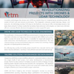
DRONE AND LIDAR TECHNOLOGY IN CIVIL ENGINEERING
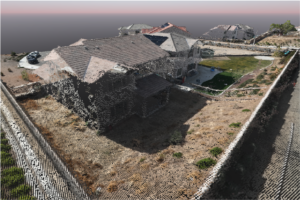
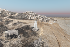
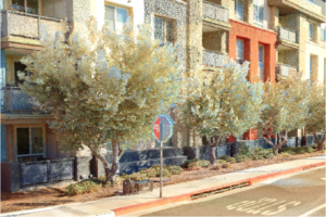
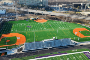
The combination of drones and LiDAR has revolutionized civil engineering, enabling rapid data collection over large areas. Drones equipped with LiDAR sensors capture highly accurate 3D terrain data, which is invaluable for large-scale projects like road construction, land development, and environmental assessments. This data improves design accuracy and facilitates long-term maintenance planning, helping engineers anticipate potential issues early.
By collecting data quickly and safely, projects benefit from reduced timelines and better resource allocation, resulting in more efficient execution and cost savings.
TAILORED SOLUTIONS FOR ENHANCED DECISION-MAKING
Integrating LiDAR into project workflows allows for customized solutions that meet the unique needs of each project, from urban developments to environmental studies. Real-time data collection facilitates accurate simulation of design changes, enabling better decision-making and proactive risk management. This approach ensures that every decision is based on the most current and reliable data, leading to higher efficiency and more successful project outcomes.
LiDAR and drone mapping also enhance topographic surveys by providing centimeter-level accuracy, improving design optimization and planning. These tools are particularly beneficial for mapping hard-to-reach or hazardous locations, reducing both time and labor costs.
Real-World Applications
LiDAR and drone technology streamline processes such as topographic surveying and facility renovations. They eliminate the need for manual data collection in difficult-to-access areas and integrate seamlessly with energy-efficient systems, boosting sustainability.
ADVANTAGES OF LIDAR TECHNOLOGY
Using drone based LiDAR systems allows rapid data collection in environmentally sensitive areas. LiDAR sensors can penetrate dense canopies from the air to get accurate ground shots in sensitive overgrowth which are inaccessible by foot, and invisible using photogrammetric methods.
- High Accuracy and Precision: LiDAR can generate 3D models with centimeter-level accuracy, providing engineers with the precise data needed for tasks like terrain mapping and infrastructure analysis.
- Rapid Data Acquisition: Compared to traditional surveying methods, terrestrial based LiDAR and LiDAR-equipped drones can quickly survey large areas, saving time and accelerating project timelines.
- Cost-Effectiveness: Though the initial cost of LiDAR technology may be high, the time and labor savings it provides over the course of a project make it a highly cost-effective solution.
ENHANCING SAFETY & PROJECT MANAGEMENT
LiDAR technology enhances safety by reducing worker exposure to hazardous areas, while drones capture data remotely, minimizing risk. The 3D models also streamline project management and improve team collaboration.
RTM leverages the latest Drone and LiDAR technology to ensure precision, safety, and efficiency, helping clients reduce costs, speed up timelines, and make informed decisions for successful outcomes. By streamlining processes like topographic surveying and facility renovations, LiDAR and drone technology offer significant advancements in efficiency and precision.